

THINK LIKE A MOUNTAIN
Finding wise paths to the future by understanding nature’s evolutionary past.
About Montek
Montek brings the concept of “digital twins” into nature conservation: building a 3D model in the computer that corresponds spatiotemporally to real protected areas, covering terrain and landforms, ecosystems, species distribution, and human activities. Driven by real-time data, the model can simulate risks, anticipate disasters, and support management decisions—providing a scientific basis for decision-making without disturbing the real environment.
Private Edge Deployment: Your data stays on your land. Total privacy, zero leaks.
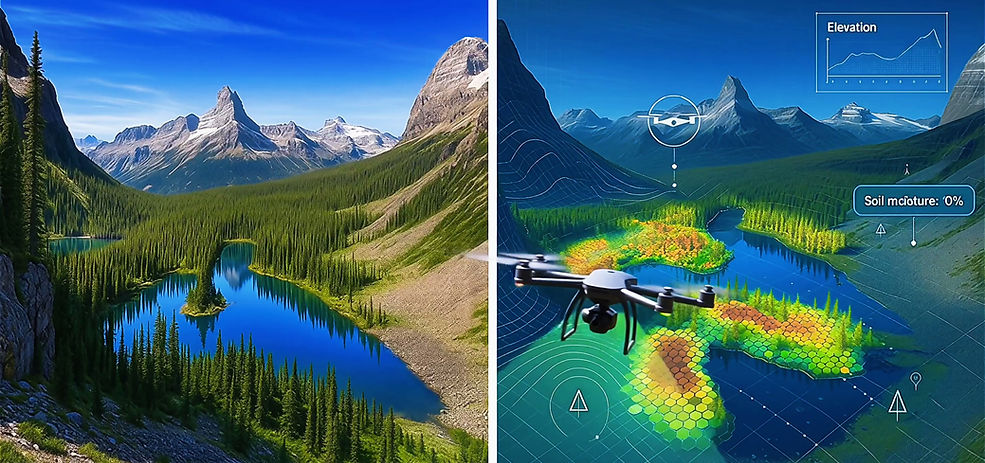

Three Core Modules
Montek has three core modules: the Sensing Module, the AI Intelligence Module, and the Digital Platform Module. The Sensing Module supports control, maintenance, and data transmission for a variety of field sensing devices such as drones and infrared cameras. The AI Intelligence Module uses a YOLO model to automatically identify field imagery captured by the Sensing Module, providing alerts and decision support. The Digital Platform integrates a 3D map engine and geospatial analysis tools to visualize both sensing data and AI outputs on fully 3D terrain.


Montek Products
The Montek hardware family is designed around the sensing, communication, and computing needs of protected-area field operations. From front-end AI recognition and ranger-carried positioning to LoRa mesh networking and field-based edge computing, these products work together to support the stable operation of the Montek digital-twin protected-area management system
in environments without public network access.


Applications
Montek Box

Mobile Data Collection System

NEWS


